top of page
Niamh Lenihan
Urbanist, Place-Maker, Architectural Technologist, Maker
A snapshot of various projects I have worked on, from model making to high street studies and mapping analysis and furniture making.
 Schematic map of the city - highlighting rail, guided bus, open spaces, historic core, and local centres and their walking catchment areas. |  Proposed plans for the reconfiguration and extension |  Model of new city in Oman. CNC routered base, metal etched roads, laser cut buildings. River valley effect sprayed and textured by hand. |
|---|---|---|
 Model of new building infill on high street in Winchester. | 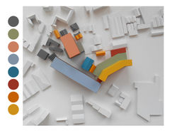 Model of scheme designed during Cass Cities. Each colour represents a different use, making the site super mixed. |  Ground floor view of scheme on the Old Kent Road. Shows the different activities on the ground floor, as well as access and movement arrangement across the site |
 Using photos of models to test space. |  Studying the high street shops on the Old Kent Road. Looking at depth within the block. | 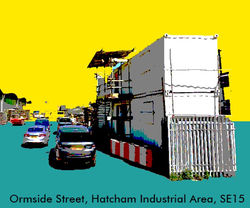 Stylised view of Hatcham Road Industrial area. |
 Old Kent Road Study Area. Schematic Map showing block layouts |  Student Accommodation plans. 2nd year arch. tech project. |  Using shadow to create spaces. |
 Sketch plan of House by The Lough. |  Designing a scheme with a full mix - residential, educational, office, industrial, social. Designed to accommodate existing businesses and enrich the local economy. |  Using a model to create spaces between buildings. Photographing models like this creates a realistic sense of what a space might be like |
 Development Sketch - tracking HGV movement around the site. |  Isometric view of new stairs location in House by The Lough. | 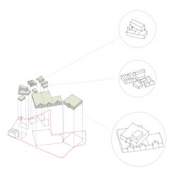 Sorting businesses into types, in order to carefully relocate existing tenants while site is being redeveloped. |
 Local Centres Cambridge. 5 min walkable catchment areas |  Loft Study. Drawing exercise. |  Sketching the Old Kent Road |
 An interactive model with standardised blocks of 100 - 1000 square meters to investigate site arrangement, with regard to specific businesses. | 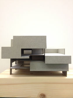 Card sketch model of the Victoria & Albert Museum proposed for the Stratford Waterfront scheme on the London Olympics site |  Industrial Uses on lower floors. Office above |
 Cork City hand drawn map |  GIS produced map, showing business types, by category in the Old Kent Road Opportunity Area |  Winchester High Street linear sketch |
 Using GIS to map businesses with yards. This exercise allows us to calculate the external space used by many businesses. |  Ground Floor -1 Plan of student accommodation project from Year 2 of Architectural Technology. |  Card model of the Stratford Waterfront Site |
 Model showing connecting stairs between floor plates. Sprayed to imitate concrete. |  Elevation of residential development in Cork City, showing adjacent existing buildings. | 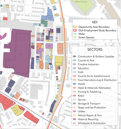 Close up of the Old Kent Road business category map. Produced using GIS software. |
 Photo montage using sketching an Photoshop |  Sketch of street showing mix of shops and businesses. |  Showing features of a town for master planning purposes. Roads, water, woodland and buildings are highlighted here. |
 Model made in walnut and photographed to create a realistic scene. |  Masterplan model used for public events to describe proposals for the town. Heritage buildings are shown in timber. Yellow denotes buildings to be redeveloped. |  Sketch of scheme in Ealing, London |
 Section through private dwelling. drawings used for planning purposes. |  Photography. Building in Glasgow. |  Site plan showing residential scheme arrangement and level changes, used for planning application in Cobh, Co. Cork. |
 Quick drawing showing the relationship between the retail units and the underpass of the new building, which will be used for deliveries and loading. |  Initial design showing low rise scheme, then evolving to a bigger scheme, with a statement high street building. |  Card model of student accommodation. Part of 2nd year project in Architectural Technology |
 Simple street facade models are great at showing the existing character of an area. |  Mapping exercise as part of an essay to investigate the wholesale baking industry in London. |  Table made using mainly waste pieces. Push pull secret drawer to side |
 Walnut & wool chair made with traditional joints. |  Locating the area that I studied for an essay on super-diverse high streets. |  Sketch of imaginary corner block |
bottom of page